Description
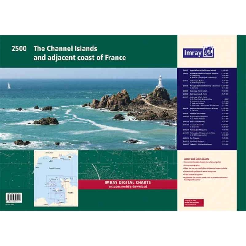
Imray 2500 Channel Islands Chart Pack | YOT0856 ISBN 9781846238611
Covering Alderney, Guernsey, Jersey and Cherbourg to St Malo in a folio of 17 handy A2 charts in a sturdy plastic wallet.
The chart pack includes all the navigational charts and tidal data for passage, approach and mooring.
Ideal for small craft.
Included
- 2500.1 Approaches to the Channel Islands
- 2500.2 Cap Barfleur to Alderney, including plans of Charbourg
- 2500.3 Alderney & Burhou, including plan of Alderney harbour
- 2500.4 Passages between Alderney & Guernsey including plan of Dielette
- 2500.5 Guernsey, Herm & Sark
- 2500.6 East Guernsey & Herm
- 2500.7 Guernsey & Sark plans – St Peter Port, Beaucette Marina, Sark Anchorages, Guernsey south coast anchorages
- 2500.8 Passages between Guernsey & Jersey, includes plan of Carteret
- 2500.9 Jersey & Les Ecrehou
- 2500.10 Approaches to St Helier, including St Helier Harbour plan
- 2500.11 East Coast of Jersey
- 2500.12 Jersey to Granville, including plan of Granville
- 2500.13 Plateau des Minquiers
- 2500.14 Plateau des Minquiers to St Malo, including St Malo plan
- 2500.15 Iles Chausey
- 2500.16 St Malo & La Rance, including continuation to Lyvet
- 2500.17 La Rance – Cancaval to Lyvet


Reviews
There are no reviews yet.