Description
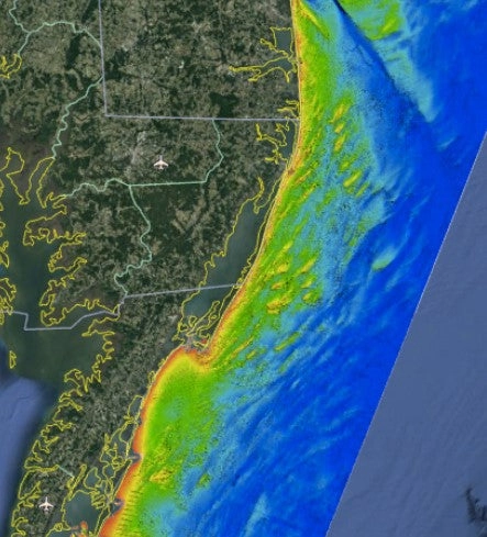
Chesapeake Bay Nearshore fishing map 3D with high resolution images of the seafloor.
**Preview map is LOW RESOLUTION. See gallery below for HD sample images**
- : Chesapeake Bay Nearshore fishing map features high definition 3D images of the seafloor.
- Location: Chesapeake Bay Nearshore fishing chart coverage includes: from Wildwood Crest, NJ, to south of Virginia Beach, VA from the coast to approximately 30 miles offshore.
- Fishing Map Size: 3,000 square miles of potential fishing spots.
- Depths: 10 ft to 120 ft
- Works on: Lowrance, Simrad, Raymarine, B&G, VesselView, iPhone, iPad, Android tablet.
- Resolution: Varies depending on the quality of data available. In general, shallower depths are higher resolution.
- Notes: With StrikeLines’ HD view of the ocean floor you’ll see exactly where those potential fishing spots are on the map. See where all the wrecks, sand waves, rock formations, and other structures are in realtime on your GPS unit, mobile device, or computer.
- Updated: 2/9/19 (Chart Card Version), 2/13/19 (Download Version). Dramatic resolution improvement.

Reviews
There are no reviews yet.